
Artificial Intelligence to Help Farmers See Cloud-Covered Fields, by Jonathan Amos
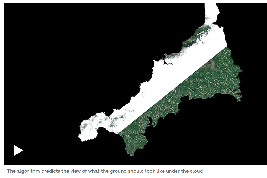
“A Cornish start-up has developed a technique using artificial intelligence to predict what the surface of the UK looks like under gloomy skies.”
“Aspia Space's technology can produce a clear synthetic image of fields in all weathers.”
“This means that for a farmer wanting to assess their crop performance this year, instead of getting just a handful of cloud-free Sentinel-2 pictures of their fields through the growing season, they can now have a Sentinel-2-like image every time the radar satellite comes overhead.”
“Aspia's Jim Geach says the reactions he's had so far have been very encouraging, and believes the algorithm will open up the six-year archive of cloudy Sentinel-2 imagery to all kinds of new analysis, from mapping trends in drought to tracking the extent of frost and snow cover.”
“‘We have a way of identifying flood risk at a highly granular scale, because you can go back through the entire archive and ask: What fraction of time was a given pixel ever saturated by water? And, of course, that's a map that's going to be changing over time as the climate changes,’ he explained.”